Posted by: Felix Halpaap, Photos by: Stéphane Rondenay
With SWaMMIS coming to an official end soon, we set off for the final project meeting on Sotra on Monday, 16 September. What a great time it’s been since the start nearly four years ago, and the meeting turned out to be a worthy conclusion!
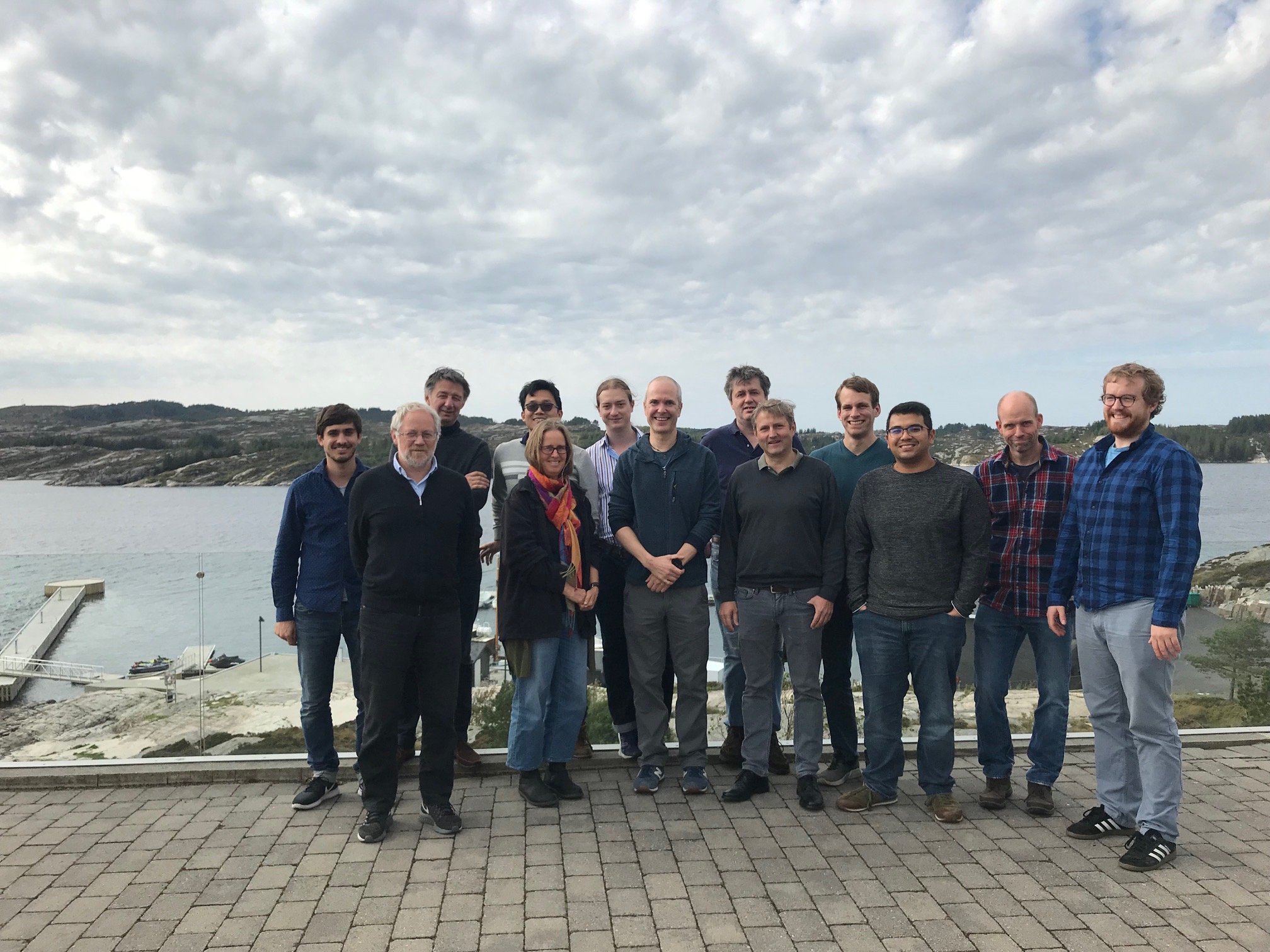
Group photo at the Panorama Hotel
We checked in at the Panorama Hotel all the way at the southern tip of Sotra. Sotra is a narrow, north-south-stretching island made up of pre-Caledonian basement rocks, and separates Bergen from the open North Sea. Here, we were optimally located for our field trip to some world-class outcrops on the third day of the meeting. But first, we spent two days of exciting geoscientific discussions in a cozy conference room – away from any distractions except the view of the sea and rocks. Continue reading Synthesis meeting and field trip report→
Participants
Håkon Olaf Austrheim (UiO)
Saskia Goes (Imperial College London)
Felix Halpaap (UiB)
Ritske Huismans (UiB)
Henk Keers (UiB)
Thomas Meier (Uni Kiel)
Florian Millet (Lyon-UiB)
Lars Ottemöller (UiB)
Stéphane Rondenay (UiB)
Christian Schiffer (Univ. of Durham/Uppsala Univ.)
Hasbi Ash Shiddiqi (UiB)
Hongliang Wang (UiB)
Sebastian Wolf (UiB)
17 September
10:00 Departure Bergen UiB Realfagbygget (Science Building)
11:00 Arrival Panorama Hotell
11:30 Lunch
13:00-15:00 Block 1 – Intro; Seismic imaging and observations
– 13:00 Stéphane: Introduction and overview of SWaMMIS
– 13:40 Felix: Earthquakes track the flow of fluids from slab source to mantle wedge sink
– 14:20 Thomas: Variable spatio-temporal clustering of microseismicity in the Hellenic Subduction Zone as possible indicator for fluid migration
15:30-17:30 Block 2 – Seismic imaging and observations
– 15:30 Hasbi: Characterisation of intraslab earthquakes in the Indo-Myanmar subduction zone
– 16:10 Florian: Seismic imaging of subduction zones with 3-D Kirchhoff migration of receiver functions
16:50 Discussion
19:00 Dinner
18 September
9:00-10:30 Block 4 – Geodynamic modelling
– 09:00 Hongliang: Modeling slab dehydration and fluid migration in subduction zones
– 09:40 Saskia: Mantle wedge temperatures and their potential relation to volcanic arc location
11:00-12:30 Block 5 – Geodynamic modelling; Norwegian margin
– 11:00 Sebastian: Factors controlling back-arc extension or overriding plate shortening a numerical modeling study of ocean-continent subduction systems
– 11:40 Ritske: Geodynamic modelling of the Norwegian margin
12:30 Lunch
14:00-16:00 Block 6 – Norwegian margin
– 14:00 Håkon: Ancient earthquakes in the exhumed rocks of western Norway
– 14:40 Christian: Fossil subduction structure beneath the periphery of the North Atlantic basin
– 15:20 Lars: Seismicity of western Norway
16:30-18:00 Block 7 – Discussion, wrap-up
19:00 Dinner
19 September
Field excursion to the high pressure / ultra-high pressure rocks of Holsnøy
09:00-11:00 Boat transport to Holsnøy
11:00-16:30 Visit to several world-class geological localities of Holsnøy
16:30-18:00 Bus transport back to Bergen
Volcanic arcs are chains of volcanoes that form above a subducting slab, for example, the Cascades in the Pacific Northwest, the Japanese Archipelago, the Aleutian Islands, and parts of the Andes. Volcanic arcs are a result of rising magma produced in the mantle wedge, but the exact mechanisms controlling the arc position are debated. This study led by SWaMMIS collaborators at Imperial College London finds that the cold corner of the mantle wedge plays a key role. Results from kinematically driven 2D thermo-mechanical modelling help constrain the influence of various factors, including subduction velocity, slab dip, slab age, overriding plate thickness and the depth of decoupling between the slab and the overriding plate.
Western Greece hosts one of the world’s more intriguing and complex subduction systems. To the north, the subducting slab is buoyant continental crust; to the south, the subducting slab is denser oceanic crust. This study provides a detailed description of the transition from continental to oceanic subduction using state-of-the-art seismic imaging techniques on a large data set of local earthquakes. The results help us to better understand how and why fluid processes and seismicity change across the region.
Writer Ellen Viste joined our first field trip to Holsnøy in 2015, and was struck by how much sampling has been done over the years at one of the main outcrops of high pressure rocks on the island. The visit inspired a thought-provoking article in the Norwegian magazine Frifluftsliv about the legalities — and ethics — of collecting rocks.
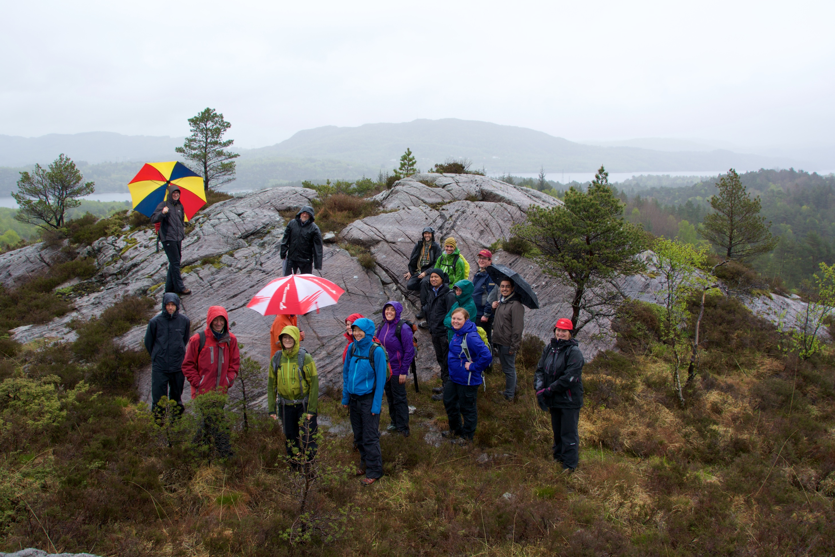
In stark contrast to our first field trip, the second SWaMMIS outing to Hølsnøy took place under brilliant sunshine. The international group included rockhounds from Australia and the U.K. as well as locals eager to learn more about the hills they grew up hiking in.
You can find additional background on the Holsnøy field area and our field trip leader Håkon Austrheim here.
Blocks of “dry” garnet granulite (anorthosite gabbro) within an eclogitized matrix.
We would like to welcome you to the next SWaMMIS field trip on 27 June 2017!
You can find some background on the Holsnøy field area and our field trip leader Håkon Austrheim here.
Logistics
Meeting time: 8:15 in front of Realfagsbygget.
Driving to Holsnøy takes about half an hour. Please bring your own lunch – once we are further out on the small and winding roads of Holsnøy, we cannot double back to reach grocery stores or restaurants. The weather forecast looks incredibly good, so make sure to bring sunscreen. But as the locals know, the weather forecast can’t always be trusted, so also have a rain/windproof jacket. Also, do wear waterproof shoes (maybe also gaitors), as the ground could be very wet after this weekend’s rain showers.
As for geological tools, magnifying glasses will be handy. A hammer is not required – the spectacular outcrops should rather be preserved, and we will bring 2 to 3 hammers for the whole group, which should be sufficient in case we come across something interesting.
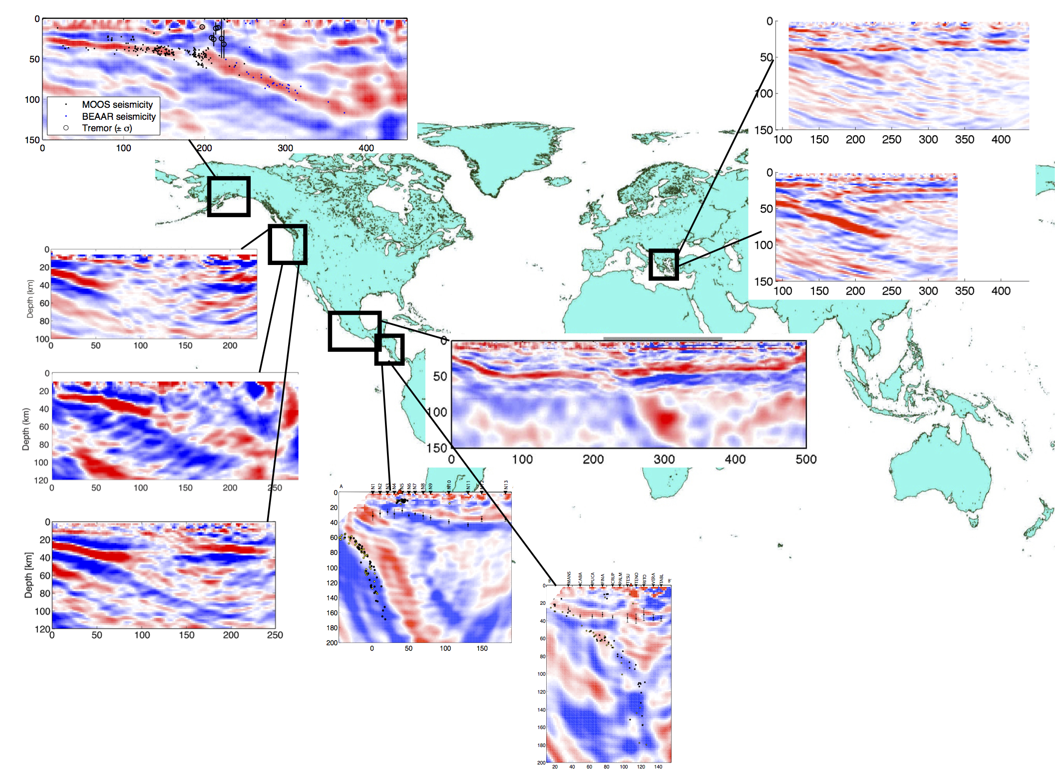
Here is a catalogue of subduction zones worldwide that have been studied using an imaging technique called the 2D Generalized Radon Transform. This technique picks up sharp changes in the propagation speed of teleseismic waves (generated by earthquakes) as they travel through the earth. In the seismic profiles below, the dipping bands of red/blue show the subducting slab as it plunges into the mantle. Subduction zones worldwide exhibit diverse geometries ranging from extremely steep subduction (e.g., Nicaragua and Costa Rica, where the subducting slab is nearly vertical) to rather flat subduction (e.g., Mexico).
Håkon Austrheim leads the SWaMMIS field trips to the world-class outcrops of Holsnøy. Håkon is a professor at the University of Oslo, and a petrologist specializing in fluid-rock interactions and pseudotachylytes.
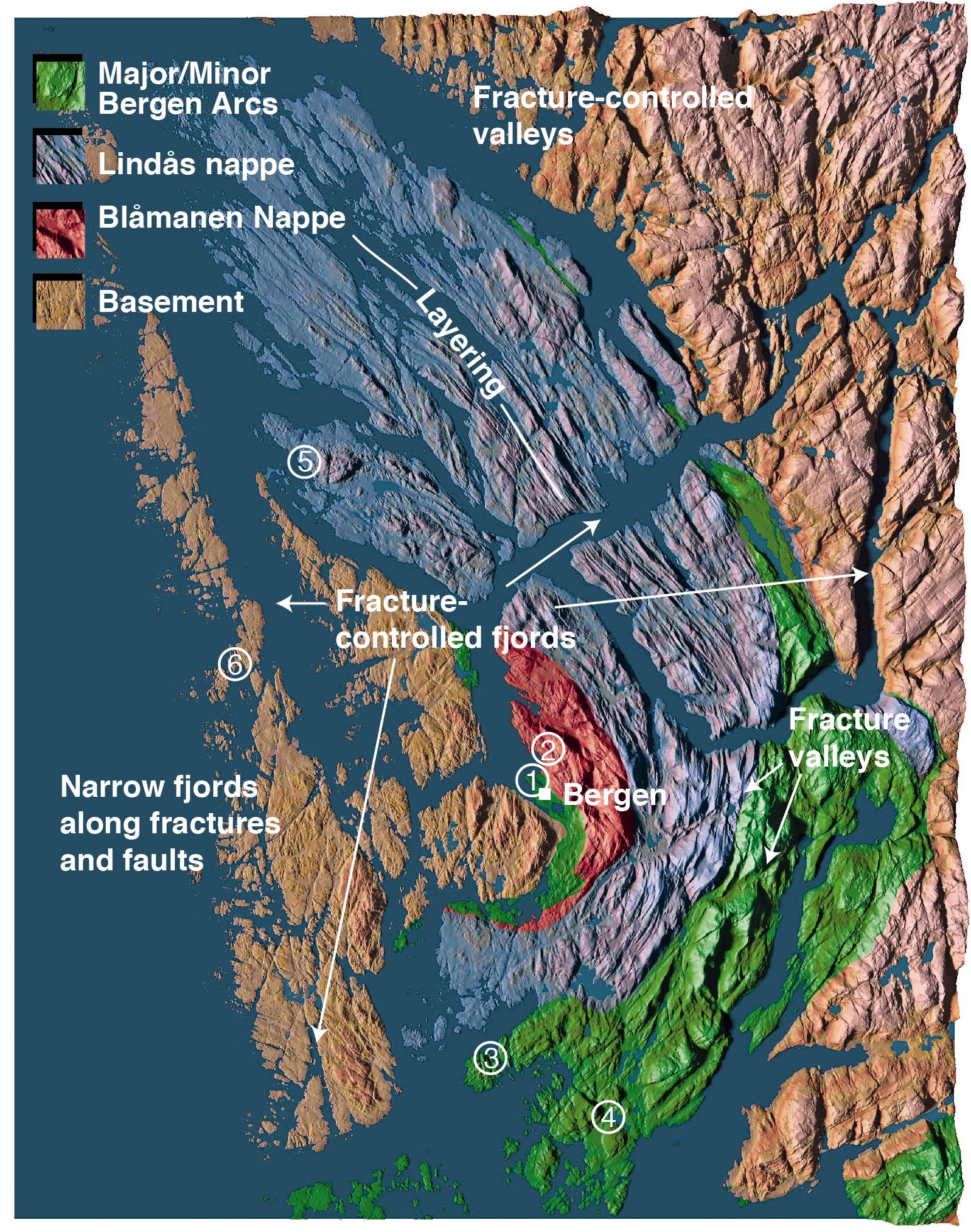
Geologic terranes of the Bergen area. Holsnøy is the island labelled with the number 5, and is part of the Lindås Nappe. Map from the website of Håkon Fossen; see his excellent page on the Bergen Arcs System for more information.
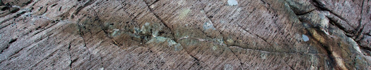
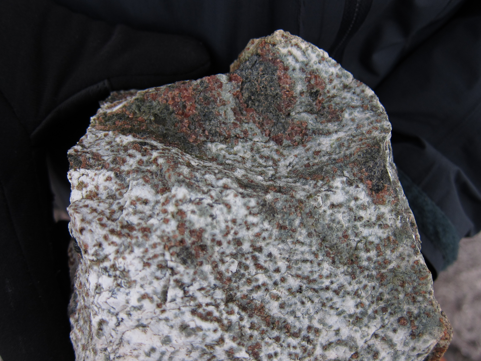
The outcrops on Holsnøy reveal the complexity of rock reactions in the deep continental crust. During the Caledonian Orogeny (400 to 450 million years ago), these rocks were 60 km down at the base of an ancient mountain belt, where the pressure-temperature conditions would be expected to transform granulite facies rocks into ecologites. However, the outcrops we see at the surface today contain both types of rock — white-grey granulite and dark green ecologite. Why is this? Because the process of eclogitization not only requires high pressures and temperatures, it also needs water (H2O). H2O can come from hydrous minerals in the rock or from fluids percolating through the rock. The granulite of the Holsnøy outcrops is rather dry, and thus ecologitization occurred only where it came in contact with aqueous fluids.
Granulite (white) and ecologite (dark green) with red-brown garnets.
Pseudotachylytes (locally molten rock, quickly cooled as amorphous glass) within some outcrops on Holsnøy are evidence of earthquakes at the base of the Caledonides mountain belt, at depths far deeper than where one would normally expect earthquakes according to the brittle-ductile transition (usually around 15 km). Earthquakes deeper than 40 km depth, termed “intermediate depth earthquakes”, are observed today in active subduction zones and at the base of the Himalaya. The mechanism behind intermediate depth earthquakes remains one of the outstanding questions in seismology.
Håkon was one of the first geologists to recognize the field record of deep earthquakes, which led to a number of high-profile publications about the geology in Bergen’s backyard (see, for example, Pseudotachylytes Generated During Seismic Faulting and Eclogitization of the Deep Crust). He has also shaped current ideas that metamorphism cannot be predicted through pressure-temperature conditions alone, but that fluids are usually required to transform an otherwise metastable rock.
How “vein” are rock-stars? This is perhaps one of the most photographed outcrops in the Bergen area. Fluids circulating through this vein transformed the surrounding granulite (grey) into eclogite (green).Blocks of “dry” garnet granulite (anorthosite gabbro) within an eclogitized matrix.
On Friday the 22nd of May, a group of intrepid geo-enthusiasts braved the elements to visit the extraordinary rocks found on the island of Holsnøy. The field trip was led by Håkon Austrheim from UiO. Håkon took us to three localities on the island where we saw world-class examples of high-pressure and ultra-high-pressure metamorphic rocks that were transformed deep below the surface and exhumed during the Caledonian orogeny. The metamorphic rocks of Holsnøy will help us better understand dehydration processes and earthquakes that occur in subduction zones, which is the central goal of project SWaMMIS. More excursions are planned over the next four years, so stay tuned if you missed this one – we can’t guarantee as moist an outing, but the rocks are sure to be as impressive!
You can find additional background on the Holsnøy field area and our field trip leader Håkon Austrheim here.
Holsnøy Field Trip
Subduction zone Water and Metamorphism: a Modelling and Imaging Study